Showing posts with label Hydrological model. Show all posts

Aug 28, 2015

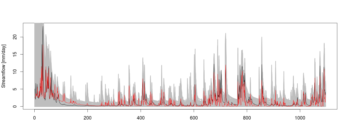
(Ensemble) Hydrological Modelling, calibration, and FUSE

Claudia Vitolo has a series of R tutorials for using a single hydrological model, or a combination of models to estimate hydrological component using a modular framework to diagnose differences between hydrological models.  I find it very interesting, and seems the procedure can be integrated to be used in our approach of estimating large scale hydrological components using JGrass-NewAGE system. That mean while the FUSE can be used to estimate the any component at the subbasin scale and use to estimate the uncertainty in the prediction,  while the  JGrass-NewAGE system can be used to integrate the process to estimate at large scale. This is in my list to try in near future! 

The three tutorial are:
  1.  FUSE model in RHydro package (part 1: simple simulation) Here
  2. FUSE model in RHydro package (part 2: calibration) Here
  3. FUSE model in RHydro package (part 3: ensemble) Here

Enjoy it ! 

May 19, 2015

The spatial and temporal evolution of contributing areas: Nippgen et'al, 2015

I am always interested on the representation of topography and their conditioning into the hydrological modelling. I have seen this accepted paper of Brian McGlynn and his co-workers entitled "The spatial and temporal evolution of contributing area". At the moment, I didn't go through it  but the topic is very  interesting, so I am saving to my list to read papers. The introduction section (objective of the paper ) reads as follows:

"Here we present a parsimonious but fully distributed modeling framework that incorporates topographically driven lateral water redistribution and eddy covariance derived spatially disaggregated evapotranspiration measurements to simulate streamflow and the spatial distribution of water stored in the watershed through time. The goal of the model development and this particular application was to inform our understanding of the spatial and temporal dynamics of runoff source areas. Utilizing and testing this diagnostic modeling framework in conjunction with empirical measurements of hillslope connectivity through an extensive network of shallow groundwater wells [Jencso et al., 2009; 2010; Jencso and McGlynn, 2011] we approximated watershed connectivity to investigate how runoff source areas change in space and time over the course of two water years in a snowmelt dominated system."


Mar 23, 2015

Spatial variability on hydrological modelling

In my view, the advancement of hydrological modelling towards distributed and semi-distributed approach is aims to identify which spatial variability of model inputs are important and which one is not.  That is why the forward and backward effort in favour of  the two approach. In summer 2014(about five month), I have been working "a little" on the effects of one of model (structural) inputs, routing (flow) distance, on model results.   Since I started working on the effects of spatial variability of hydrological model inputs,  I have seen new (very interesting) papers came out. Some of these are attached in the reference (I try to upgrade the references as they came by me). My work  can be seen as a look into  one aspect of the whole issues, the spatial variability of model inputs (and structures) in hydrological response modelling.

References

  • McMillan, H. , M. Gueguen, E. Grimon, R. Woods, M. Clark, D. Rupp. (2014). Spatial variability of hydrological processes and model structure diagnostics in a 50 km2 catchment. Hydrological Processes 28(18): 4896-4913. Pre-print Article
  • J. M. Schuurmans, M. F. P. Bierkens. Eect of spatial distribution of daily rainfall on interior catchment response of a distributed hydrological model. Hydrology and Earth System Sciences Discussions Discussions, 2006, 3 (4), pp.2175-2208. <hal-00298750>
  • Minet, J., Laloy, E., Lambot, S., and Vanclooster, M.: Effect of high-resolution spatial soil moisture variability on simulated runoff response using a distributed hydrologic model, Hydrol. Earth Syst. Sci., 15, 1323-1338, doi:10.5194/hess-15-1323-2011, 2011.
  • Yang, D., Herath, S. and Musiake, K. (2000), Comparison of different distributed hydrological models for characterization of catchment spatial variability. Hydrol. Process., 14: 403–416. doi: 10.1002/(SICI)1099-1085(20000228)14:3<403::AID-HYP945>3.0.CO;2-3
  •  Marthews, T. R., Dadson, S. J., Lehner, B., Abele, S., and Gedney, N.: High-resolution global topographic index values for use in large-scale hydrological modelling, Hydrol. Earth Syst. Sci., 19, 91-104, doi:10.5194/hess-19-91-2015, 2015.